Castlerea to Ballintober, Co Roscommon


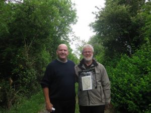
A walker with a cloudy, damp day to make the most of in south-west Co Roscommon can hardly do better than step it out with Martin Dunne. As Rural Recreation Officer for the county, Martin’s trodden more of the fields and byways of Roscommon than most, and he’s an infectious enthusiast to boot. “If you can look forward to your work every day,” he says self-effacingly, “well, you’re very lucky.”
The Suck Valley Way is one of those modest, Waymarked Ways that tends to slip under the radar of walkers looking for something more high and heroic. It meanders for 60 miles through West Roscommon and East Galway, more or less on the banks of the not-very-dramatic River Suck, in the sort of countryside that John McGahern caught so brilliantly — low-rolling, green, rural and quiet.
The country lane that Jane, Martin and I followed out of Castlerea was thick with buttercups and frothy with the tall umbellifers that some call cow parsley and others gypsy lace. Crossing the railway line, Martin stooped and put his ear to the tracks like Buster Keaton. But the trains, too, seem to run on sleepy time in this part of the world. Wherever the 9.32am from Roscommon town had got to, it certainly wasn’t within earshot. But then, not much was — just the lowing of distant cows and the mutter of a tractor as a farmer turned his cut hay before the rain arrived.
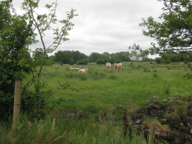
This flattish Roscommon landscape with its thick old hedges and sedgy fields is cattle country, and horse country too — we passed a little group of them up to their backs in lush vegetation, with the occasional glimpse of their long brown heads shaken high above the rushes as they snorted away the flies. Black turf showed many feet thick in the walls of the drainage channels easing recent extravagant rainfall away from the fields. A hare sprang up from its form among the clover and sprinted away, ears tucked back along its spine, leaving a darker track through the wet grass.
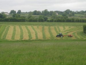
The farmer on his red tractor was nearly through with his hay-turning, leaving a field of thick green and yellow strips like a pumpkin skin, a scene calling out for a painter. But which artist could hope to capture on a canvas the low roar of the machinery, the slow movements of the turning and the rich smell of the cut grass? Those are not impressions you can capture and pick over later at your leisure; you have to stop, lean on a gate and savour them right then and there.
When were the High Crosses carved and erected at Emlagh’s rural monastery? In the 8th century, or the 11th, or somewhere in between? No one seems to know — but there they were in a field beside the Suck Valley Way, fragments on a plain stone pedestal: bosses, interlaced decoration, triangular symbols of the Trinity, all deep in buttercups and knee-high grasses, presided over by a quartet of bullocks with crumpled horns and expressions of profound puzzlement.

We drifted on through lanes fragrant with the pineapple smell of mayweed. A donkey came to his fence and screeched deafeningly for a good minute. He only shut up when he’d got a good grip of Jane’s scarlet anorak sleeve in his long grey teeth.
“I run local walks once a month,” remarked Martin as we left the fields and turned into Ballintober village past the ivy-smothered old castle.
“Dozens turn up from all over Roscommon. If you get locals involved, they’re more likely to make sure these walks and paths stay open and in good nick — because they’ll have been reminded what a really beautiful bit of Ireland we’re lucky enough to live in.”

Way to go
MAP: OS of Ireland 1:50,000 Discovery 39, 40; map in Suck Valley Way booklet.
TRAVEL: Rail: (irishrail.ie) To Castlerea. Bus (buseireann .ie): 429 (Galway), 457 (Roscommon), 460 (Sligo). Road: N60; park near station.
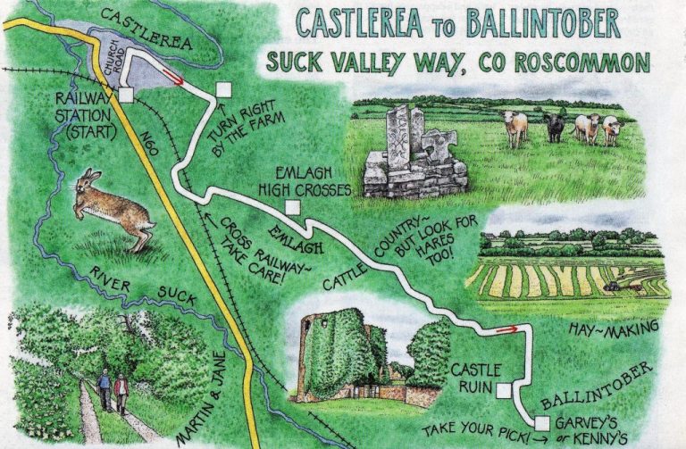
WALK DIRECTIONS: (Return by taxi, 094 962 0310; bus 457 on Fridays; or car): From Castlerea Station, turn right up Church Road; right along R377 Knockroe (‘Suck Valley Way’/SVW fingerpost) for ¾ mile (pavement). Right by farm (SVW); in two-thirds of a mile cross railway. At Tjunction, left (yellow walking man/YM) to recross railway. In 200m left; follow YMs; pass Emlagh High Crosses; dogleg across road beyond, and on (SVW). Lane becomes field path (yellow arrows/YAs) to road at Cloonavindin. Left (YM) to T-junction by cottage at Rosmeen. Right (YM) for 100m; left over ladder stile (YM). Follow YMs up side of meadow. At far end, through gap in bank and on (YAs); follow field edge round to right; continue to stile on to road by Ballintober Castle. Left into Ballintober.
LENGTH: Five miles — allow two-and-a-half hours.
GRADE: Easy. CONDITIONS: Field paths, country lanes.
DON’T MISS: Beautiful views over Suck Valley; Emlagh High Crosses; Ballintober Castle; St Brigid’s Well.
REFRESHMENTS: Garvey’s or Kenny’s in Ballintober; Hell’s Kitchen in Castlerea (there’s a train in the bar!).
ACCOMMODATION: Clonalis House, Castlerea. Tel: 094 962 0014; clonalis.com.
GUIDE BOOKS/LEAFLETS: Map/booklet in local TICs; also order from suckvalley. com/walk.htm.
INFORMATION: info@suckvalley.com; suckvalley.com. Co Roscommon walking clubs: rosactive.org. Tourist Office: Boyle (071- 966-2145) or Roscommon (090-662-6342). Discoverireland.ie/walking.
csomerville@independent.ie
First appeared in the Irish Independent on 30 October 2010