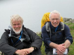
‘It’s a wonderful thing,’ mused Sean Mullan, ‘how the walking leads to the talking.’ This is such an incontrovertible truth that Sean, a much-travelled Derryman come to anchor in rugged north Donegal, has named his out-and-about-on-foot touring business ‘Walking & Talking In Ireland’. Come Irish, English, Germans or Americans – a day or two in the countryside with Sean, an ex-teacher gifted in drawing out his walking companions, and all tongues are magically loosened. That’s what Jane and I found, too, on our exploration of Rathlin Island’s road less travelled, the south-going peninsula that leads to moody and beautiful Ushet Port.
It was a good omen for the day when I found that the Rathlin ferry was Canna, an old friend last met 25 years ago when she bumped me over to Iona on a stormy day in the Hebrides. Canna gave us an easier passage this morning; Sloch na Marra, ‘valley of the sea’, the notorious rip tide in Rathlin Sound, lay as quiet as a sleeping wolf, and we landed and set off down the island road in good order.

The first thing we saw was Richard Branson’s toothy smile, flashing from an information board. In 1981 the dashing gazillionaire ditched near Rathlin Island after crossing the Atlantic in his hot air balloon. He was rescued by the Rathlin boatman, Tommy Cecil. As a thank-you, Branson generously forked out for several island amenities, including, rather appropriately, a rescue craft. If he’d been a medieval monarch in similar circumstances he’d have endowed a monastery on Rathlin in thanksgiving – St Richard’s, probably.
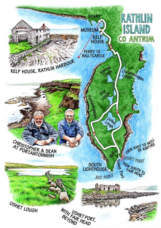
We called in to the excellent Boathouse visitor centre and island museum for a quick chat with Tom McDonnell and a look at his fabulous Rathlin photographs, then headed from the shore road past the shell of the kelp factory that once brought work and prosperity to the seaweed-processors of the island. Soon the harbour and buildings were behind us, and we strolled the up-and-down road past Craigmacagan and Kinkeel Loughs, beautiful sheets of still water fringed with reeds and paved with broad green lily pads.
The day held that very specific but intangible mix of peace, isolation and melancholy peculiar to islands in soft grey weather. Greylag geese cackled in the bog, a hare bounced nonchalantly along the road ahead of us, and a scarcely fledged meadow pipit sat fatly on a fence post, its feathers fluffed right out against the wind like a starlet in a mink coat.
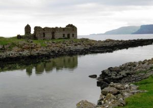
The road curved between two hills and dipped down a bank of wild thyme to reach Ushet Port, poignant name for a rocky inlet overlooked by a house of rough stones and a kelp station in roofless ruin. Seven seals were in occupation, sprawled out on the rocks like immensely fat old clubmen after three good lunches apiece. A small flotilla of eider ducks sailed in the inlet, flightless and nervous at the height of their moulting season. Beyond across the Sound, the square-cut sheer cliffs of Fair Head loomed in dark purple, with the domed mountain of Knocklayd spread with sunshine in the south-west; while round to the east the long hills of the Mull of Kintyre rolled in sea mist, seemingly within swimming distance. If I ever find a more haunting place and prospect, I will bottle it and sell it for gold. Maybe it will be sold for gold anyway, if the rumoured half-billion barrels of oil under Rathlin Sound should one day be tapped.

Our homeward path lay along the cliff tops above basalt ledges topped with grass and spattered with pink thrift and yellow kidney vetch. Ahead stretched the western peninsula of Rathlin, an arm of white chalky limestone capped with dark chocolate basalt. We talked of birds, flowers, men, music, writers, history and happenstance. If this walk had never come to an end, I don’t think any of us would have cared a rap.
WAY TO GO
MAP: OS of Ireland 1:50,000 Discoverer 5; downloadable map/instructions at walkni.com.
GPS: satmap.com
TRAVEL: A2 to Ballycastle, then Rathlin Island ferry (booking essential; check timetable – 028-2076-9299; rathlinballycastleferry.com).
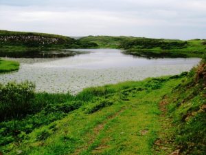
WALK DIRECTIONS: Turn right along harbour past Boathouse Visitor Centre. Fork right past Kelp House ruin along shore road. At T-junction, right along main island road for 2.8 km (1¾ miles) to end of road at Ushet Port. Returning, in 200 m turn left through gate into RSPB Roonivoolin reserve. Left along fence, following ‘Roonivoolin Walk,’ ‘Coastal Walk’ and black/orange arrows. Optional path outside fence, reached by stiles – NB – unguarded cliff edges! Where fence ends at cliff, right inland along fence (arrows). Descend into valley between telegraph poles, aiming for waymark post on saddle of ground. Follow waymarks and grassy track, keeping Ushet Lough on right, to reach road. Left to harbour.
LENGTH: 6 miles (9.5 km) – allow 3 hours (plus bird, seal watching time)
GRADE: Easy
DON’T MISS:
• Boathouse Visitor Centre
• Kelp House and seals at Ushet Port
• Cliffs of south-west coast (take care!)
REFRESHMENTS: McCuaíg’s Bar (028-2076-0011); Manor House (see below – open 1 May – mid Oct)
BEST PICNIC SPOT: Grassy bank overlooking Ushet Port.
ACCOMMODATION: Bayview Hotel, Portballintrae, Co Antrim BT57 8RZ (028-2073-4100; bayviewhotelni.com) – ring for information on deals/packages. A great base for exploring the Causeway Coast.
GUIDED WALKS: Sean Mullan, Walking & Talking Ireland (074-745-9366; WalkTalkIreland.com).
INFORMATION: Walking tour operators, local walks including Discover Ireland’s National Loop Walks and Northern Ireland’s Quality Walks, walking festivals throughout Ireland: walkni.com; discoverireland.ie/walking
RATHLIN ISLAND (B&B accommodation, Boathouse Information Centre etc.): rathlin-island.co.uk
BALLYCASTLE TOURIST OFFICE: 028-2076-2024;
discovernorthernireland.com
csomerville@independent.ie