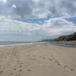
Murlough National Nature Reserve, Co. Down
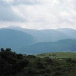
We could only set out in hope. The marsh fritillary butterflies, their open wings as beautiful as stained glass windows of amber and pearl, would be there, we knew, among the sand dunes of Murlough National Nature Reserve. It was the right time of year, midsummer, to see them on the wing, and the Murlough dunes behind the long curved beach at Dundrum were rich in sky-blue buttons of devil’s bit scabious, main foodplant of these delicate and very rare butterflies. But … it was raining. Clouded, grey and pelting over the crest of County Down, with the Mourne Mountains sulking under blankets of mist that they’d pulled over their shoulders instead of displaying themselves at the end of the strand in full and proper glory. Marsh fritillaries don’t like rain – why should they, these lovely creatures made for sunlight and warmth? They, like the Mournes, would be in hiding today.
So we started out into the drizzle, and of course it cleared within a few minutes. What’s more changeable than Irish weather? We didn’t see the marsh fritillaries, as things turned out. But as for what we did see…
You couldn’t imagine a more perfect habitat for wild flowers, wild birds and insects – warm, sheltered, varied, carefully protected and managed by the National Trust, with acid parts and lime-rich parts, humps and hollows facing every which way, places for the rain to pool, salty bits and sunny bits. These dunes have been slowly growing, developing, shifting and stabilising since before man learned to farm or to make bronze in Ireland. They are immensely old, hugely varied and wonderful to walk through, following a tangling maze of paths.
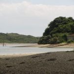
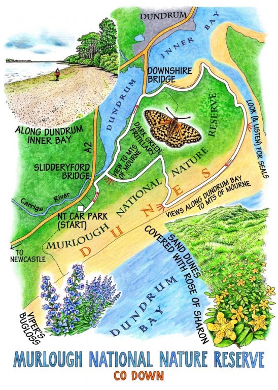
The first path we found led us through rough grassland thick with white dune roses, heath bedstraw, wild pansies of intense purple and yellow, fragrant woodsage. We left the nature reserve for the shore path along the tidal slabs of the Carrigs River where it pours in and out of Dundrum Inner Bay, and saw fleets of swans, drifts of mallard, and curlews stalking with high-stepping deliberation through the mud as they stabbed and burrowed with long down-curved beaks. A flotilla of sailing dinghies came heading in from the sea, bumping and grounding in the shallow channel, and a big heron jumped up from close by and took off like an old grey brolly suddenly come to life.
We crunched the pebbly shore of the bay, walking south along the inlet towards the big sandspit at the mouth where a group of grey seals lay singing, their snouts upturned like giant musical slugs to bring forth eerie echoing calls. One seal came drifting up the tideway, inspecting us as he passed, then lapsing back into the water with a rasping sigh.
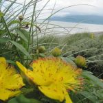
The strand turned south-west and ran in a long tan curve towards the multi-coloured seafront of Newcastle. The Mournes still smoked like dampened volcanoes above the town. We idled along, picking up sea urchin exoskeletons far lighter and more fragile than any bird’s egg. Then a yellow post showed the course of a nature trail through the dunes. The sun came through the clouds. Magnificent orange and black butterflies began kettering from hollow to hollow – dark green fritillaries rather than marsh fritillaries, we reluctantly decided. It didn’t really matter a jot. We were content to walk the path through groves of Rose of Sharon, wild strawberries and royal blue viper’s bugloss, making back west and watching the mighty heads of Slieve Bearnagh, Slieve Commedagh and Slieve Donard itself break free at last into evening sunshine.
WAY TO GO
MAP: OS of Ireland 1:25,000 Activity Map ‘The Mournes’, Nature Trail leaflet map (see below)
TRAVEL: ‘Murlough Beach & National Nature Reserve’ signed off A2, 1 mile out of Newcastle towards Dundrum. NT car park – free members, moderate charge non-members.
WALK DIRECTIONS: At top end of car park, left through gate; left along duckboards; in 50 m they bend right, but keep ahead on grass path by fence. The path soon turns left down steps, then on, following yellow-topped posts/YTP. At Slidderford Bridge path runs close to A2, then on along south bank of tidal Carrigs River, following yellow arrows and Lecale Way/Newcastle Way. At Downshire Bridge, don’t turn left across bridge, but bear right along road. In 100m, left (‘Newcastle Way’), then right along shore. Follow shoreline round the point, south then south-west towards the Mourne Mountains, for 2 ½ miles. At OS ref 405338, look for YTP in dunes on right, turn right inland and follow National Trail/YTPs back to car park.
LENGTH: 5 ½ miles/9 km – allow half a day to enjoy the wildlife
GRADE: Easy
CONDITIONS: At very high tide you might have to follow shoreline among the dunes rather than on the beach.
DON’T MISS:
• Wide views across Dundrum Inner Bay
• Seals basking on the sandspit at entrance to Dundrum Bay (bring binoculars)
• Sensational wild flowers and butterflies along the Nature Trail
REFRESHMENTS: Cottage Café, NT car park – great baking and nice big pots of tea. Check National Trust website for opening times
BEST PICNIC SPOT: on the beach – out of the wind!
ACCOMMODATION: Burrendale Hotel, Newcastle (028-4372-2599 www.burrendale.com ) £ 140 (but much cheaper special offers) dble B&B.
NATURE/TRAIL and OTHER LEAFLETS from NT kiosk in car park
MURLOUGH NNR: nationaltrust.org.uk
INFORMATION: As template
BOOK: As template
INFORMATION: Newcastle Tourist Office (028 4372 2222)
discovernorthernireland.com
WalkNI.com
csomerville@independent.ie
http://en.wikipedia.org/wiki/File:SS_Great_Britain_stranded_in_Dundrum_Bay.jpg
