I first walked the Bangor Trail through north-west Mayo’s Nephin Beg mountains more than twenty years ago. Although the background memory is indelibly stamped with the harsh beauty and isolation of that 30-mile trek through Ireland’s wildest mountain range, the foreground is all one blur of rain – spotting, spitting, sluicing, steady old rain. And mist. Every time I’ve caught sight of the Nephin Beg since then, they’ve either loomed grey and insubstantial in shawls of rain, or stood cut off at the knees by mist. So it was a great moment when I pulled back the bedroom curtains in the Clew Bay Hotel down in Westport and saw wall-to-wall blue sky. Now, then!
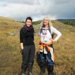
Cathleen Fergus, County Mayo’s recently appointed Rural Recreation Officer, had given up a day of her time to come and walk the Letterkeen Loop in the southern skirts of the Nephin Beg with Jane and me, and it’s fair to say we set off from the forested valley of Srahmore in good fettle, with sun and cloud shadows chasing each other across the mountains. Wild tales could be told of the Bangor Trail, the ‘old and only road into Erris’ with its bare rocky course winding over remote hills and through valleys. The people of the Nephin Beg seldom saw a stranger, except the hardy drovers who brought cattle along the boggy mountain track between Bangor Erris and Newport mart – 64 miles there and back in hobnail boots. Cathleen’s father was a drover himself, she told us, though he’d walked the Achill Island-Newport route and never trod the Bangor Trail itself.
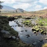
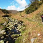
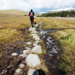
We stepped and stumbled north up the stony road, its boulders and pebbles clinking underfoot. We splashed and squelched over black peat bog seeded with stepping stones that sparkled with mica chips reflecting the sun. Mountain streams crossed the trail in boulder beds, forded with small leaps from one stone to the next. We squeezed leaf buds of bog myrtle, sniffing the pungent fragrance on our fingers, and stooped to inspect the fattest spider in the Nephin Beg, curled motionless in a self-woven gossamer hammock slung between two myrtle sprigs, her pale abdomen zigzagged with brown and black.
A mizzling gauze swept through the valley and across the conifer plantations, more like a softening of the air than rain. We topped a rise to see the ‘old and only road’ ribboning away ahead over the shoulder of the mountain. Apart from the conifers, nothing in this empty, magnificent landscape spoke of either 21st or 20th century.
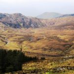
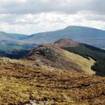
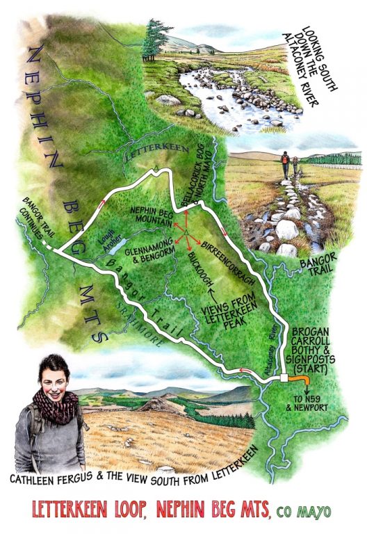
Near the top of the rise the Letterkeen Loop broke away from the Bangor Trail and took us up along a line of rotted fenceposts on a very sodden and sloppy path. It rose to a saddle of ground, wound through some stubby escaped conifers and went on up to the rocky peak of Letterkeen. The view from here was sublime – north into the long bowl of gold-shouldered Nephin Beg Mountain, west and south to a great cliff-faced horseshoe of fells trending down towards Glennamong and the sleek hollow back and head of Bengorm in the south, then north-east across the vast flatland of the great bog of Bellacorick and the rise of the land towards the north Mayo coast.
We sat nibbling chicken-and-pesto sandwiches and watching a ewe standing motionless guard over her two tiny blackfaced lambs. Then it was a slip and a slide down the boggy hillside, and a crunching finish to the walk along a forest road between banks of white wood-sorrel bells, scented with pine resin and lit by shafts of sunlight slanting among the massed ranks of the trees.
WAY TO GO
MAP: OS of Ireland 1:50,000 Discovery Sheet 31; downloadable map/instructions at discoverireland.ie/walking.
GPS: satmap.com
TRAVEL: N59 Newport-Mulranny road; on outskirts of Newport, turn right (‘Letterkeen, Bangor Trail’, then ‘Srahmore, Letterkeen Loop, Nephin Beg’) for 12 km/8 miles. Park at Brogan Carroll Bothy.
WALK DIRECTIONS: Follow purple arrows/PA across Altaconey River and up glen on Bangor Trail for 4 km/2⅔ miles. Lough Aroher Loop (red arrows) turns right; don’t follow this, but keep ahead along Bangor Trail for another 100 m. Then turn right (PA) off Bangor Trail, following fence posts to top of slope, then through trees and up to rocky peak. Follow PA down off peak, through forestry to track; left to descend to forest road; right to return to Brogan Carroll Bothy.
LENGTH: 10.5 km/6½ miles – allow 3-4 hours
GRADE: Moderate/hard
CONDITIONS: Bangor Trail is very stony, mountain slopes very wet and boggy; many streams, stepping stones etc. Proper hill walking clothes and boots essential. NB: No dogs allowed – sheep country!
DON’T MISS:
• Information boards on the local trails and countryside at the start
• Views west and south of Bengorm and Glennamong mountains
• Views from the rocky peak over Bellacorick Bog and much of North Mayo
REFRESHMENTS: Picnic on the peak at Letterkeen.
ACCOMMODATION: Hotel Newport, Main Street, Newport, Co Mayo (098-41155; hotelnewportmayo.com – please ring for deals); Clew Bay Hotel, James Street, Westport, Co Mayo (098-28088; clewbayhotel.com) – from €50 dinner, B&B pp.
WALKING in IRELAND: Walking tour operators, local walks including Discover Ireland’s National Loop Walks, walking festivals throughout Ireland: discoverireland.ie/walking and coillte.ie
BOOK: Christopher’s book Walking in Ireland (Ebury Press) contains 50 of his favourite Irish Independent walks.
INFORMATION: Newport TIC (098-41895); countymayo.com
