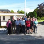
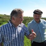
A lovely morning over mid-Tipperary, and a jolly party of walkers leaving Upperchurch to explore the farming country north of the village. Talking nineteen to the dozen, we hopped over ladder stiles and forged up gorse hedges, gaining height above the village, walking through freshly mown hayfields where the lime-green stubbles brushed our boots with a crunchy hiss at every step. ‘There’s no perfume to touch it,’ smiled Mary Ryan, stopping to savour the thick yeasty smell of the cut field.
The talk ranged far over the common experience of the group, growing up in rural Tipperary before the advent of widespread electricity, cars and TV. ‘We cured our own bacon,’ said Mary’s husband Con, ‘smoked it in the chimney, and that was all the meat we ever ate back then.’ Mary recalled going up into the heather to pick whortleberries, ‘hurts, we called them; you’d gather the hurts and bring them home to make jam.’ Con struck in, ‘And there’d be opportunity to meet someone of the opposite sex in the heather. They were very sweet, those berries…’
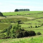
We skirted the rim of Glenbeg, a lovely secret bowl of a valley patched with cattle meadows and big hayfields where a tractor was roaring and shaking up the hay rows. Up on the crest of Knocknameena the striped ridges and lumpy hollows of a vanished village lay printed in the turf. ‘In 1854,’ remarked Billy Clancy, thinking of hard old times, ‘my great-grandfather had to travel all the way to Kerry to fetch seed potatoes – there was a belief that the sea wind down there kept the blight away. But when he brought them home, they were rotten anyway.’
An old walled boreen ran along the lip of the hill where we paused to take in the tremendous view of sunlit mountain ranges round the compass – Comeraghs and Knockmealdowns over the Waterford border in the south-east, the blue peaks of the Galtees to the south; the calm feminine bulk of Sliabh na mBan further east, and the ragged face of the Devil’s Bit in the north. Some of these peaks held alignments of standing stones and burial mounds, observed Frankie Shortt; but whether as stations for smoke signals or for more arcane purposes, no-one could say now. ‘Funny thing to think of,’ mused Frankie, ‘the old folk sending their messages from hilltop stations down and out through the valleys – and nowadays the Broadband is doing the exact same thing!’
And what of Eamonn a Chnoic himself, Ned of the Hill, after whom the walk is named? A chivalrous raparee, by all accounts, who rescued his landlord’s daughter when she was lost on the hills. The grateful lord cancelled the bounty on the outlaw’s life, but that news failed to spread fast and far enough to save Ned. His cousin Dwyer swiped off his head with an axe, and was not best pleased to be turned away empty-handed when he presented the bloody trophy in hopes of a reward.
As we turned downhill towards Upperchurch, a fairy fort – a bowl barrow smothered in a tangle of elder and blackthorn – provoked memories of the old tradition of cuardaíocht, the visiting of neighbours by night, when ghost stories would be told by the fire. ‘Some of them had the knack of a story, all right,’ recalled Packie Purcell. ‘You’d sit and listen with your ears and eyes all open wide, and by God you’d be frightened to go to bed! But television has killed all that stone dead.’
Back down in Upperchurch we sat down a dozen strong in Kinnane’s pub for bacon, cabbage and spuds. What else would you want after such a morning’s walk and talk?
WAY TO GO
MAP: OS of Ireland 1:50,000 Discovery 59; downloadable map/instructions at www.discoverireland.ie/walking
TRAVEL:
Rail (www.irishrail.ie) to Thurles
Bus (089-122-9041, www.upperchurch.ie); Thurles-Upperchurch by Rural Transport, Mon, Wed, Fri; other days/times by arrangement.
Road: From Thurles take Nenagh road; in 2 miles, left on Newport road; in 10 miles, right to Upperchurch.
WALK DIRECTIONS: Left at Ryan’s pub along road. In ¾ mile, just after right bend, go right across ladder stile/LS by bridge (purple arrow/PA). Left to cross another LS; right up fenced path and follow path over LS’s to top of rise. Left along laneway; immediately right up stony path, over LS (PA) and on. Cross next LS; right (PA) along hedge, and follow it uphill. At top, right (LS, PA) along sunken path to reach road by house. Left along road; watch for corrugated barn on right; right here (LS, PA) along cobbled laneway. Follow LS, PA to fence; right downhill (PAs) and follow hedges to reach laneway. Left (PA) for 100 yards; right (LS, PA) and immediately right again, parallel with laneway, following field edges down slope. Cross streams, following PAs to road. Left for 300 yards; right up lane (PA), over field to road; left into Upperchurch.
LENGTH: 5 ½ miles; allow 2½-3 hours
GRADE: Moderate
CONDITIONS: Lanes and grassy paths.
Don’t Miss…!
• View of Sliabh na mBan and other mountains from Knocknameena.
• A bacon and cabbage dinner in Kinnane’s of Upperchurch – unbeatable!
REFRESHMENTS: Picnic, or lunch in Kinnane’s pub.
ACCOMMODATION: Inch House, The Ragg, Nenagh Road, Thurles (0504-51348; www.inchhouse.ie) – superb country house
WALKING IN IRELAND: Walking tour operators, local walks including Discover Ireland’s National Looped Walk, walking festivals throughout Ireland: www.discoverireland.ie/walking.
This walk is based on http://www.discoverireland.ie/Activities-Adventure/eamonn-a-chnoic-loop/71502
UPPERCHURCH WALKING FESTIVAL: 5-7 November (con@gleann.net; www.upperchurch.ie)
INFORMATION: Nenagh TIC, Pearse Street (067-31610); www.discoverireland.ie/shannonregion
csomerville@independent.ie
Irish Independent Walk of the Week Christopher Somerville
16 October 2010


