Irish Independent Walk of the Week Christopher Somerville
2 October 2010
No 76: Slieve Foye, Carlingford, Co. Louth
Carlingford’s a favourite place of mine. The little Co. Louth harbour town boasts two castles, more history than you can shake a stick at, friendly and funny locals, and the majestic backdrop of Slieve Foye, queen of the Cooley Peninsula mountains. It was Slieve Foye I was here to climb, a promise I’d made to myself years ago, the first time I caught sight of the mountain’s jagged profile from the slopes of the Mourne Mountains across Carlingford Lough.
Slieve Foye isn’t a mountain to be frightened of, but it’s one to respect, even at the modest height of 589m. You want decent weather and an absence of low cloud to make your way safely among its rocky outcrops. Today’s brisk blue sky offered a chance that just begged to be seized.
I found the stony lane that leads directly up the hill behind Carlingford to Golyin Pass on the skyline. It was a steep climb between old stone walls where monbretia extruded cheerful tongues of flaming orange. Cheviot sheep with Roman profiles grazed deep in the bracken, scarcely bothering to look down their aristocratic noses as I puffed by. Up at the pass a group of young mountain bikers whooped and hollered with delight over the view, and turning round I had to admit it was a corker, out over Carlingford and its slate-blue lough to the kingly Mournes lumping high and handsome on the northern horizon.
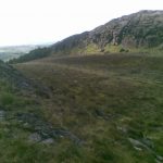
The path up Slieve Foye rose as a grassy strip heading for the summit rocks. I paused for breath among the first outcrops, looking back across the pass to the split peak of Barnavave where louche and legendary Queen Medbh joined battle with mighty Cúchulainn in the long ago and far away. Then I went on, a slippery but easy climb with purple arrow waymarks as an occasional reassurance, snaking over bog and heather up to the summit where a plain concrete triangulation pillar clung like a jockey in a race-horse saddle to the back of a great dark lump of glacier-scratched rock. What a mind-melter of a view, from the majestic Mournes to the far-off Wicklow Hills down in the south, the Ring of Gullion out west, and the sail-dotted waters of Carlingford Lough and Dundalk Bay in the east.

I could cheerfully have sat on that summit rock all day, and probably slept the night away there too. But I didn’t wish to be caught by the flying columns of rain I could see marching up across the Midland plains. So it was up and on, hurdling rocks, scrambling down stream beds, descending where I could, until the solid line of forestry below gave me something to aim for.
A final joyous slide on my bottom down a grassy slope to fetch up against the forest fence, and I was following the blue waymark arrows of the Slieve Foye Looped Walk back to the Golyin Pass and a quick march down into Carlingford, where a collie dog on a tin roof was auctioning for World’s Most Monotonous Barker. I beat the rain into P.J. O’Hare’s by the shortest of heads.
WAY TO GO
MAP: OS of Ireland 1:50,000 Discovery 36; downloadable map of Slieve Foye Loop at www.discoverireland.ie/walking
TRAVEL:
Bus: 161 Dundalk-Newry (www.buseireann.ie); 502, 701 (www.louthlinx.com)
Road: M1 to Dundalk; R173 to Carlingford. Main car park by Tourist Information Centre.
WALK DIRECTIONS: NB – Several waymarked Looped Walks are based on Carlingford, including the Slieve Foye Loop (blue arrows/BA) which forms part of this walk but doesn’t actually ascend Slieve Foye. The walk from Golyin Pass to Slieve Foye summit is marked (patchily) with purple ‘Looped Walk’ arrows.
From car park, pass Taafe’s Castle; left at T-junction; right through Carlingford village square; climb steep road to right of Savage Victuallers (‘Táin Way’/TW) until tarmac bends left. To follow Slieve Foye Looped Walk (BA), turn right here. To ascend Slieve Foye, keep ahead (green arrow/TW ‘walking man’ symbol) up grassy, then stony, laneway. Follow green and red arrows and ‘Commons Loop’ uphill. Where Commons Loop turns left, bear right (yellow and red arrows/TW); follow TW up to Golyin Pass.
At red arrow, bear right on clear grass path up Slieve Foye. There are some marker posts and purple waymark arrows; near the summit these disappear, but you’ll find several obvious paths to the summit.
Descending from summit pillar – either (a) retrace steps to Golyin Pass and to Carlingford; or (b) for fit and confident walkers who can use map/compass/GPS, continue towards Eagle’s Rock with Carlingford Lough on your right. Ideally, descend when above car park at north end of forestry; otherwise, descend towards lough and forestry where you can (very steep, no defined path) and be aware of crags!
At forestry fence, right on Slieve Foye Loop (BA) to rejoin Táin Way below Golyin Pass; retrace steps to Carlingford.
LENGTH: c. 6 miles; allow 4-5 hours
GRADE: Hard
CONDITIONS: Many steep bits, up and down; bog, rock, slippery grass, heather. 589 m/1,932 ft of ascent and descent. Hill walking gear, boots, water, picnic essential. Stick advisable. Slieve Foye summit is only for fit, experienced hill walkers with confidence and stamina. Avoid in mist or heavy rain!
Don’t Miss…!
• Views over Carlingford Lough and Dundalk Bay from Golyin Gap.
• Mindblowing prospect from Slieve Foye summit.
Refreshments: Picnic at the top!
GUIDED WALKS: Contact Aude Laffon (0871-335159; www.setantatours.com)
WALKING in IRELAND: Walking tour operators, local walks including Discover Ireland’s National Loop Walks, walking festivals throughout Ireland: www.discoverireland.ie/walking.
INFORMATION:
Carlingford Tourist Office: 042-937-3033; www.carlingford.ie
csomerville@independent.ie