Irish Independent – WALK OF THE WEEK – Christopher Somerville
19 February 2011
85. Red Hugh’s Loop, Upperchurch, Co. Tipperary

Illustrated map by Claire Littlejohn – claire.littlejohn@btinternet.com
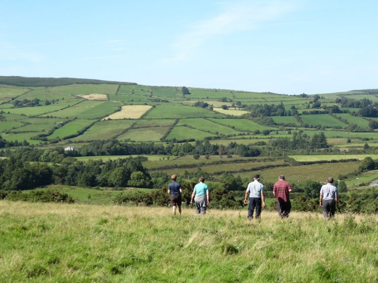
Walks don’t all have to be long. Sometimes it’s great to have a proper yomp o’er hill and dale, and sometimes you just want a post-prandial stravage like Red Hugh’s Loop, through a couple of fields and up a slope or two. On a beautiful mid-Tipperary day of blue sky and strong sun I crossed the gentle ridge of Knockmehill, ‘the bald hill’. A strange name for a place so thickly grassed and so well thatched with ancient gorse bushes.


Legends, legends. They cling to Irish soil as thickly as burrs in a blanket. Descending Knockmehill’s sedgy northern flank I thought of the young hero who lent his name to this afternoon’s walk. By all accounts Red Hugh O’Donnell was a brave and energetic leader, and a great persuasive speaker, with charm and charisma to burn. As the heir to the throne of Tír Chonaill in late Tudor times, he also represented a powerful piece in the struggle between English and Irish for supremacy. Even the dungeons of Dublin Castle couldn’t hold him. Imprisoned there as a teenager, he managed to escape (an unheard-of feat), struggling to freedom across the snowbound Wicklow Hills in January 1592. This epic trek cost him both his big toes through frostbite. It also sealed his determination to rebel against the English.
In the valley I followed an old field wall whose lichen-whitened stones were clamped together by the roots of ancient ash trees. Beyond the roadside farmyard the path climbed the steep flanks of meadows whose hawthorns had been picked clean of their crimson berries by flocks of hungry fieldfares. A big dark hare leaped up almost under my feet and scampered away, ears clamped tight along its neck.
Up under the conifer-smothered dome of Knockalough I paused to look north again, away towards the scoop of missing ground ten miles off where Old Nick once took a mouthful out of Devil’s Bit Mountain. Then it was down the forest road towards Upperchurch, thinking once more of dashing Red Hugh, who came here in 1601 on another remarkable winter trek as he tried to salvage an already doomed cause.
In the 1590s Hugh had enjoyed some notable victories over his English foes, especially at the battles of the Yellow Ford and the Curlew Pass. But then things began to go wrong for the man with eight toes. He’d begged King Philip of Spain for help, but when a Spanish force finally arrived late in 1601 it landed in south Munster, about as far away from O’Donnell’s country as could be. Nothing daunted, the young king and his supporters embarked on a midwinter march the whole length of Ireland to join the Spaniards and Hugh O’Neill on the coast of Cork. There they tasted complete defeat at the Battle of Kinsale in the New Year of 1602.
Red Hugh O’Donnell left Ireland for Spain, but he could not raise any further interest in his cause. He sickened and died there in 1602 and was buried at Valladolid, scarcely into his thirties, with all his dreams in tatters.
Walking down the forest road towards Upperchurch I pictured the young king and his army trudging south across the slopes of Knockalough through the snowdrifts of winter. We all know of O’Sullivan Beare’s great march from south to north after Kinsale, but few remember Red Hugh O’Donnell’s extraordinary expedition to reach the battleground. However, Upperchurch and its lovely little looped walk still keep his memory green. It’s not unknown for senior locals to point a walker on his way with: ‘That was the lane Red Hugh went out on his way to Kinsale. That was some man, Red Hugh – now wait till I tell you …’
So old yarns get spun into new threads.
WAY TO GO
MAP: OS of Ireland 1:50,000 Discovery 66; downloadable map/instructions (highly recommended) at www.discoverireland.ie/walking.
TRAVEL:
Rail (www.irishrail.ie): Thurles (10 miles)
Bus (089-122-9041; upperchurch.ie): Thurles-Upperchurch by Rural Transport, Mondays, Wednesdays, Fridays; other days/times by arrangement.
Road: From Thurles take R498 Nenagh road; in two miles, left on R503 Newport road; in 10 miles, follow brown ‘Trailhead’ signs to left from crossroads at Upperchurch; in 500m, forestry entrance on right. Car spaces by trailhead map.
WALK DIRECTIONS: Cross ladder stile opposite map; turn right along hedge (green arrow/GA) and purple arrow (PA). Follow hedge to corner of field; left uphill with hedge on right, over hill and down into valley. Left along valley bottom; over ladder stile; keep ahead to gate on right of house. Left up road. At a big barn on right, turn right (PA, GA in left hedge) through barnyard and on along stony track. In ¼ mile, left over ladder stile (PA, GA). Up steep field edge, doglegging right and left up to 2 stiles. Right-hand stile (PA) leads to longer Knockalough Loop; but you keep ahead over stile with GA, and on up grassy fenced path. At top, left down forest road (GA), back to car.
LENGTH: 3 miles: allow 1½ hours
GRADE: Moderate
DON’T MISS … !
• old gorse bushes in bloom on Knockmehill
• view from Knockmehill across Upperchurch to the Devil’s Bit
REFRESHMENTS: Kinnane’s pub, Upperchurch 0504-54284. Excellent pub food and hospitality
ACCOMMODATION: Inch House, The Ragg, Nenagh Road, Thurles (0504-51348; inchhouse.ie) — very comfortable country house.
WALKING in IRELAND: Walking tour operators, local walks including Discover Ireland’s National Loop Walks, walking festivals throughout Ireland: discoverireland.ie/walking.
INFORMATION:
Nenagh Tourist Office: Pearse Street (tel: 067 31610)
http://www.discoverireland.ie/Activities-Adventure/red-hugh-loop/77367
csomerville@independent.ie